Collect accurate information of your assets for Building Information Modeling (BIM) processes with efficient and precise data capture.
Painpoints
Absence of visualized 3D Models for design-reality comparison.
Advantages
Generate accurate 3D Models of the site for visual design-reality comparison.
Time and cost inefficiencies with ground solutions.
Elevated efficiency with simple data collection workflow.
Solution
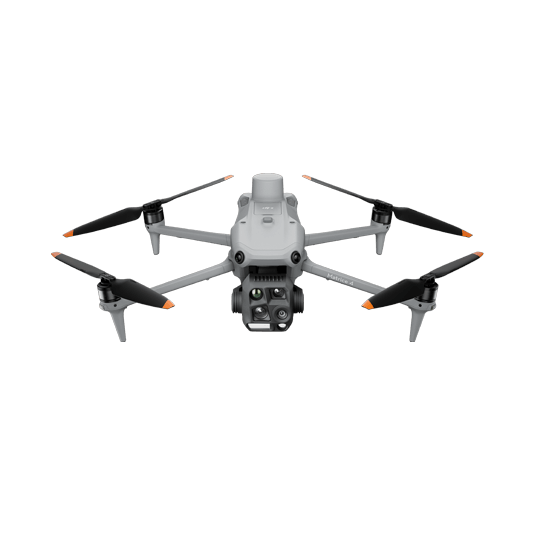
Portable Drone Surveying & Mapping Solution
The DJI Matrice 4E is a portable mapping drone suitable for single-pilot operations. Paired with DJI Terra, it can generate accurate 2D and 3D models with significant reduction on the ground control points.
Portable solution, easy to operate and to carry across multiple construction sites.
One-tap High-Quality 3D Mapping.
Centimeter-level data thanks to its mechanical shutter and RTK capability.
Obtain multiple data outputs such as 3D Models, DSM, DEM, and Point Clouds for efficient earthwork monitoring.