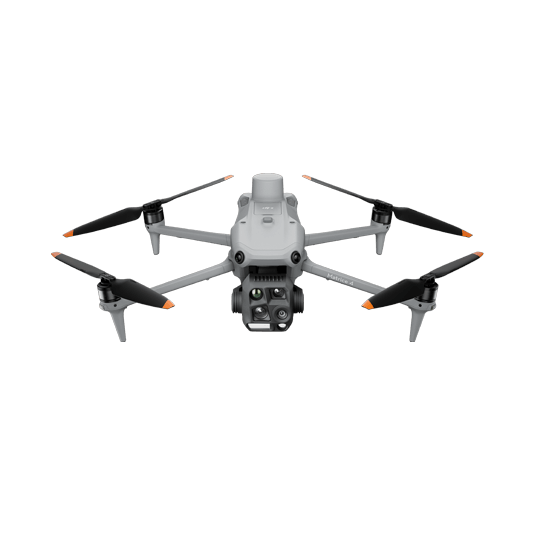
The DJI Matrice 4E is a portable surveying and mapping drone suitable for single-pilot operations. Paired with DJI Terra, it can generate accurate 2D and 3D models with significant reduction on the ground control points.
Portable solution, easy to carry and deploy.
Centimeter-level data thanks to its mechanical shutter and RTK capability.
Field-work efficiency—covers 2 km² per flight, delivering a 5cm GSD.
Real-Time Terrain Follow feature to ensure high-quality data capture in challenging and variable terrains.
Data Collection: – Plan a 2D, Linear Flight, or Smart Oblique Mission based on the actual landscape situation for regular orthomosaic images or oblique image data collection. Enable Real-Time Terrain Follow feature.
Data Processing: – Import to DJI Terra to process for DOM, DSM, Point Cloud, and 3D models.
Data Analysis: – Import DJI Terra outputs to preferred third-party software for further analysis.
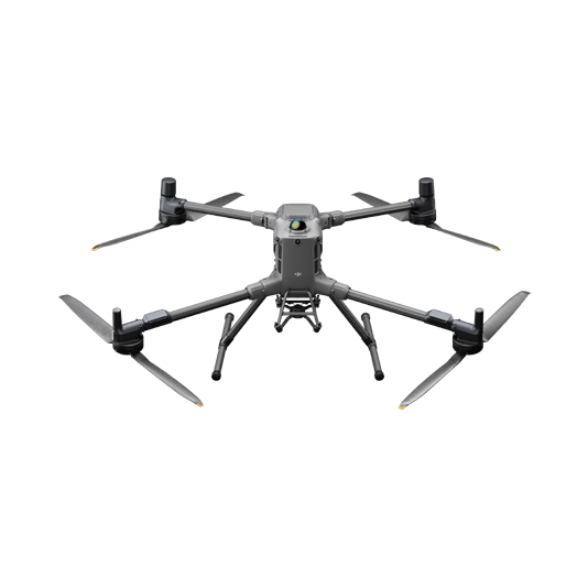
Full-Frame High-Performance Surveying and Mapping Solution
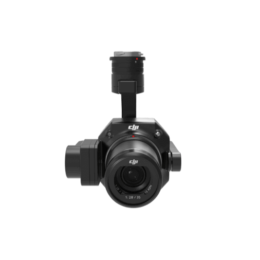
Matrice 400 paired with the Zenmuse P1 full-frame sensor and its Smart Oblique Capture feature takes aerial surveying efficiency and accuracy to a whole new level. Combine with DJI Terra for an efficient and integrated UAS surveying and mapping solution.
Generate accurate centimeter-level deliverables, significantly reducing ground control points.
Field-work efficiency—covers 3 km² per flight, delivering a 5cm GSD.
Reliable multi-purposed drone platform.
Zenmuse P1 has a 45MP, full-frame sensor to ensure high-quality data collection.
Data Collection: – Plan a 2D, Linear Flight, or Smart Oblique Mission based on the actual landscape situation for regular orthomosaic images or oblique image data collection. Import DSM files for Terrain Follow if necessary.
Data Processing: – Import to DJI Terra to process for DOM, DSM, Point Cloud, and 3D models.
Data Analysis: – Import DJI Terra outputs to preferred third-party software for further analysis.
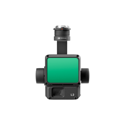
LiDAR Mapping Solution
Matrice 350 RTK equipped with the Zenmuse L2 Frame-based LiDAR, can penetrate densely vegetated areas and obtain bare ground data. Increase aerial survey efficiency thanks to its integrated 4/3 CMOS RBG Mapping camera for simultaneous Point Clouds and photogrammetry data collection.
Field-work efficiency—covers 3 km² per flight, collecting both LiDAR and photogrammetry data.
Highly integrated solution, reducing on-site time and ensuring data capture quality.
Reliable and robust multi-purposed drone platform designed to endure harsh environments and conditions.
Accurate LiDAR Data. Achieve a vertical accuracy of 5 cm or less. -Ideal for densely vegetated areas.
Data Collection: – Plan a 2D, Linear Flight, or Smart Oblique Mission based on the actual landscape situation for Point Clouds and image collection. Import DSM files for Terrain Follow if necessary.
Data Processing: – Import to DJI Terra to process for DOM, DSM, Point Cloud, and 3D models.
Data Analysis: – Import DJI Terra outputs to preferred third-party software for further analysis.