Overview

DJI Zenmuse L2 combines frame LiDAR, a high-precision IMU, and a 4/3 CMOS RGB mapping camera to deliver precise, efficient, and reliable geospatial data. Paired with DJI Terra, it provides a complete solution for accurate 3D data capture and post-processing.

High Precision

Vertical Accuracy: 4 cm;
Horizontal Accuracy: 5 cm

Exceptional Efficiency

2.5 km2 covered in a single flight

Superior Penetration

Smaller laser spots,
denser point clouds

Detection Range

250m @10% reflectivity, 100klx
450m @50% reflectivity, 0klx

5 Returns

Turnkey Solution

Point Cloud LiveView

One-Click Processing on DJI Terra

Integrated LiDAR Mapping Solution

Powered by advanced hardware, Zenmuse L2 delivers precise scanning of complex environments with extended range and faster point-cloud acquisition. Users can preview, review, and process data on-site, while DJI Terra generates Task Quality Reports and enables streamlined, one-stop post-processing for high-precision results.

High-Level Precision

By combining GNSS and a high-accuracy self-developed IMU, this solution achieves 4cm vertical accuracy and 5cm horizontal accuracy.

Exceptional Efficiency

It’s ready for work as soon as it’s powered on and can collect both geospatial and RGB data from a 2.5km2 area in a single flight.

Intuitive Operation

In conjunction with Matrice 350 RTK and DJI Terra, L2 offers a turnkey solution that is simple to use, lowering the operational threshold.

Frame-Based LiDAR

30% Extended Detection Range

Zenmuse L2 detects targets up to 250 m at 10% reflectivity (100 klx) and up to 450 m at 50% reflectivity (0 klx). The increased operational altitude of up to 120 m significantly improves efficiency and flight safety.


Smaller Laser Spots, Higher Point Density

With a reduced laser spot size of 4 × 12 cm at 100 m—just one-fifth the size of L1—Zenmuse L2 captures finer details, penetrates dense vegetation more effectively, and delivers more accurate digital elevation models (DEM).

Supports 5 Returns

In densely vegetated areas, L2 can capture more ground points beneath the foliage.

High-Density Point Cloud Output: 240,000 pts/s

In both single- and multiple-return modes, Zenmuse L2 delivers up to 240,000 points per second, enabling faster data capture and denser point clouds within the same flight time.

Dual Scanning Modes for Versatile LiDAR Operations

Zenmuse L2 supports two scanning modes to adapt to different mission requirements. Repetitive scanning delivers more uniform, high-accuracy point clouds for precision mapping, while non-repetitive scanning enables deeper penetration to capture richer structural details—ideal for power line inspection, forestry surveys, and complex environments.

Frame-based Design

The frame-based design delivers up to 100% effective point cloud utilization. Combined with a three-axis gimbal, it expands operational flexibility and enables more advanced surveying scenarios.

High-Accuracy IMU System

Zenmuse V1 can get as loud as 127 decibels at 1 meter, which is about the same volume as a jet taking off. Strong volume makes sure that information is clear. It can effectively broadcast up to 500 meters away, so it can cover even large spaces.

Improved Accuracy

The high-accuracy self-developed IMU system, combined with the drone’s RTK positioning system for data fusion during post-processing, gives L2 access to highly accurate absolute position, speed, and attitude information. In addition, the IMU system’s enhanced environmental adaptability improves the operational reliability and precision of L2.

  • Yaw Accuracy
  • Real-time: 0.2°, post-processing: 0.05°
  • Pitch/Roll Accuracy
  • Real-time 0.05°, post-processing 0.025°

Instant IMU Readiness — No Warm-Up Required

The enhanced IMU system is ready for operation immediately upon power-on, eliminating traditional warm-up time. Once RTK reaches FIX status, the aircraft can begin missions right away, enabling faster deployment and a more efficient in-field workflow.

RGB Mapping Camera

4/3 CMOS Sensor with Mechanical Shutter

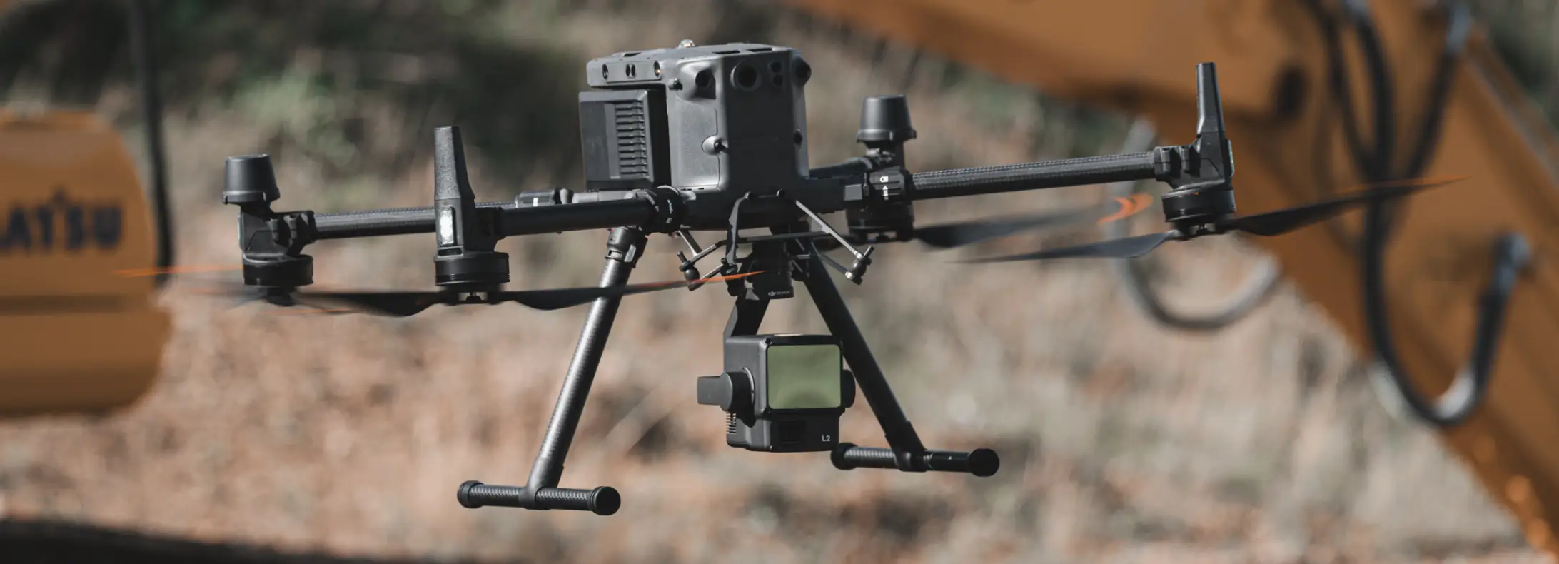
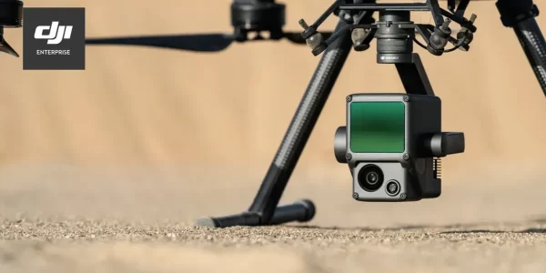
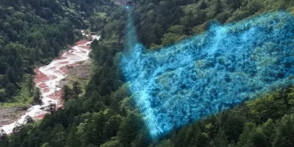
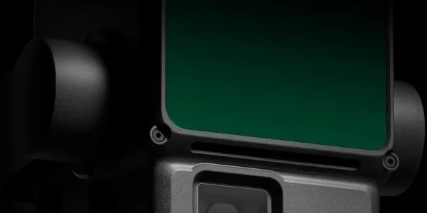
Featuring an upgraded 4/3 CMOS sensor, pixel size is increased to 3.3 μm with 20 MP effective resolution, delivering noticeably improved image quality and richer true-color point cloud detail. The minimum photo interval is reduced to 0.7 seconds, enabling faster data capture.
The mechanical shutter is rated for up to 200,000 actuations, helping lower long-term operational costs. When point cloud collection is not required, the RGB camera can also be used for photo, video, or visible-light mapping tasks, providing added operational flexibility.

Diverse Flight Route Types

Supports Waypoint, Area, and Linear Route types, for handling surveying tasks in a variety of environments.

During operation, DJI Pilot 2 supports three display modes – RGB, point cloud, and point cloud/RGB side-by-side display, presenting operational results in an intuitive way. Activating RNG (Laser Rangefinder) enables access to the distance information between the LiDAR module and the object in the center of the FOV, enhancing flight safety. It also supports four real-time point cloud coloring modes – Reflectivity, Height, Distance, and RGB.


After the operation, the 3D point cloud model [7] can be viewed directly in the album. 3D Point cloud models of multiple flights can also be merged, enabling on-site decision-making regarding operational quality.
After point cloud data collection, the DJI Pilot 2 app will automatically generate a Task Quality Report so that operators can check operational results in real-time and on-site, making fieldwork more responsive and worry-free.
In complex operational environments, users can set up RTK base stations before the operation to preemptively avoid the loss of RTK data due to interference, video transmission disconnection, or other issues. After the operation, import original files into DJI Terra to use the PPK (post-processing kinematic) process to rebuild high-precision models.
Achieve efficient and reliable one-stop post-processing when importing point cloud data into DJI Terra. Generate a standard-format 3D point cloud model with just a click after point cloud trajectory calculation and accuracy optimization. Upon ground point classification, using Ground Point Type, a DEM can be output. Point cloud quality can be analyzed with the Accuracy Control and Check function.

Request for a Quote