The Matrice 400, equipped with the Zenmuse H30T, brings enhanced thermal capabilities to Hazmat response. Expand the M350 RTK’s capabilities with a third-party payload for gas detection sensing.
Reliable multipurpose drone platform easily adapts to the mission needs.
Mission Execution: – Fly manually over the affected area to determine the severity of the situation. Switch between infrared and visual views to evaluate the situation. – Use the Link Zoom feature to zoom in simultaneously with thermal and visual sensors. – Install the IR Density Filter to increase the measurement range of the thermal sensor. – Share the coordinates with ground teams through the DJI Pilot 2 QR code or DJI FlightHub 2.
Post Mission Documentation: – Collect the videos and photos captured during the mission through DJI FlightHub 2 or download from the payload SD card to be used as supporting documentation for post-disaster analysis.
Water Rescue
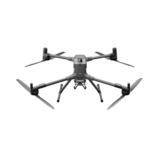
The Matrice 30T strikes the perfect balance between portability and performance, integrating a hybrid sensor with visual, thermal, and laser range finder capabilities for optimal performance in a variety of rescue scenarios.
Rugged, weatherproof mid-size airframe, provides balance between portability and endurance.
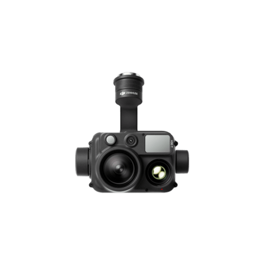
640 × 512 thermal radiometric sensor for accurate temperature readings.
Fast deployment with superior performance.
Optical zoom for close-up details from a distance.
Laser range finder to get accurate coordinates of objects.
Mission Execution: – Using DJI Pilot 2 app, add the last known location to the map as a GPS Pin. – In the DJI Pilot 2 camera view, use the AR of the pin to fly directly toward the correct coordinates. – Fly manually over search areas switching between visual and thermal views to identify the missing person. – Utilize white hot or black hot palettes as needed along with high gain mode. – Once the subject is identified, get accurate coordinates using the Pin Point function. Share Pin Point coordinates to ground teams through DJI Pilot 2 QR code or DJI FlightHub 2.
Post Mission Documentation: – Collect the videos and photos captured during the mission through DJI FlightHub 2 or download from the drone SD card to be used as supporting documentation for post-disaster analysis.
Brush Clearance and Inspection
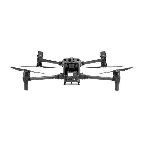
The Matrice 4T offers unparalleled portability and performance for scanning large areas with ease. Its small airframe is convenient to carry on patrol vehicles, and with visual and thermal cameras equipped, it’s the ideal solution for identifying wildfire risks.
Compact and lightweight design, around 1.2kg and easy to carry in the response vehicle.
Fast and easy deployment, get airborne in around 30 seconds.
640 × 512 thermal radiometric sensor for accurate temperature readings.
Thermal palettes and temperature measurement tools for easy data interpretation.
Automated mapping missions for quick 2D and 3D model data collection.
Mission Execution: – Plan a 2D or Smart Oblique Mission based on the actual landscape situation to generate regular orthomosaic images or 3D Models. – Fly manually over the affected area looking for hotspots. Switch between infrared and visual views (wide or zoom) to evaluate the infrastructure and vegetation.
Post Mission Documentation: – Map the affected areas for post-incident reports and preventative action briefs.