Enhance wildfire response by providing critical aerial information. Identify hotspots more accurately and improve responders’ safety while aiding in the strategic deployment of resources.
Painpoints
The rapid expansion and unpredictability of wildfires complicate ground crews' ability to evaluate the situation in real time and make accurate decisions.
Advantages
Gain real-time aerial insights, enabling firefighters to make informed, strategic decisions amidst the chaos of wildfires.
Firefighters face significant risks due to their limited knowledge of the situation.
Enhance personnel safety with advanced situational awareness, thereby reducing firefighters' exposure to hidden dangers.
A lack of information makes it difficult for incident commanders to effectively deploy resources and track the effectiveness of mitigation efforts.
Collect critical data to optimize resource allocation and monitor the impact of firefighting strategies in real time.
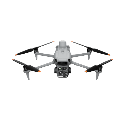
The Matrice 4T offers unparalleled portability for quick deployment missions. Easy to carry on fire response vehicles and equipped with visual and thermal cameras, it’s the ideal solution for initial risk evaluations.
Compact and lightweight design, around 1.2 kg and easy to carry in the response vehicle.
Fast and easy deployment, get airborne in around 30 seconds.
640 × 512 thermal radiometric sensor for accurate temperature readings.
Thermal palettes and temperature measurement tools for easy data interpretation.
Mission Execution: – Fly manually over the affected area looking for hotspots. Switch between infrared and visual views to evaluate the situation. – Use the Link Zoom feature to zoom in simultaneously with thermal and visual sensor. – Select a suitable infrared palette and gain mode for the conditions at hand. – Use orbit flights to perform 360 circular flights around the structure, facilitating the risk evaluation.
Post Mission Documentation: – Map the affected areas for post-incident reports and reforestation efforts.
High Performance Fire Response
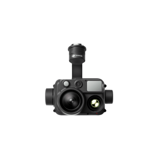
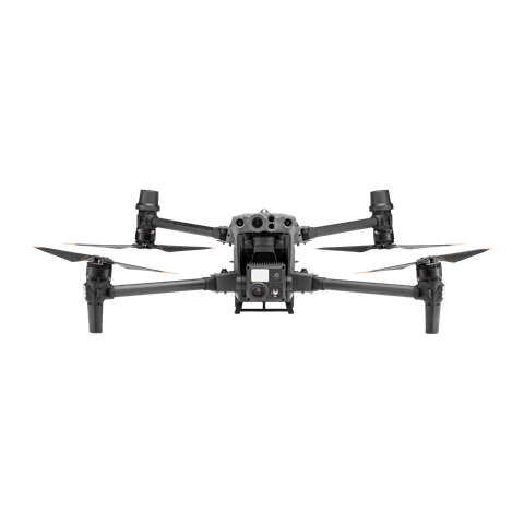
The Matrice 400, equipped with the Zenmuse H30T, brings enhanced thermal capabilities to fire response. Using the new H30T Night Scene mode, fire brigades can now gain valuable insights during low-light operations.
Reliable multipurpose drone platform easily adapts to the mission needs.
Mission Execution: – Fly manually over the affected area looking for hotspots. Switch between infrared and visual views to evaluate the situation. – Use the Link Zoom feature to zoom in simultaneously with thermal and visual sensors. – Select a suitable infrared palette and gain mode for the conditions at hand. – Install the IR Density Filter to increase the measurement range of the thermal sensor. – Get the coordinates of hotspots using the laser range finder and the Pin Point function. – Share the coordinates with ground teams through the DJI Pilot 2 QR code or DJI FlightHub 2.
Post Mission Documentation: – Collect the videos and photos captured during the mission through DJI FlightHub 2 or download from the payload SD card to be used as supporting documentation for post-disaster analysis.
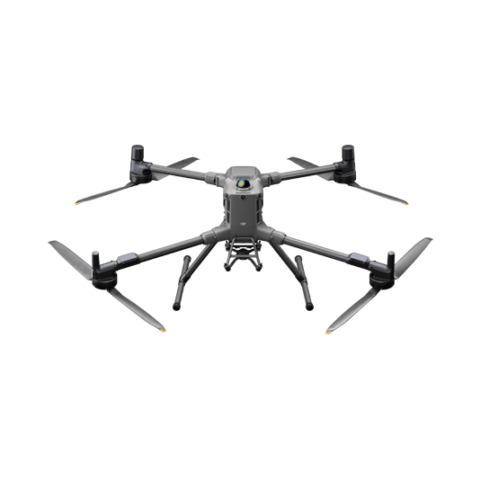
Versatile Aerial Thermal Reconnaissance
The Matrice 30T strikes the perfect balance between portability and performance. It integrates a hybrid sensor with visual, thermal, and laser range finder capabilities, ensuring optimal performance across a variety of fire emergencies.
Rugged, weatherproof IP55 mid-size airframe, provides balance between portability and endurance.
640 × 512 thermal radiometric sensor for accurate temperature readings.
Optical zoom for detailed object inspection from a safe distance.
Laser range finder to get accurate coordinates of targets.
Hot-swappable batteries and improved charging station for continuous operation.
Night scene feature provides enhanced awareness for low-light operations.
Mission Execution: – Fly manually over the affected area looking for hotspots. Switch between infrared and visual views to evaluate the situation. – Use the Link Zoom feature to zoom in simultaneously with thermal and visual sensor. – Select a proper infrared palette and gain mode for the conditions at hand. – Get the coordinates of hotspots using the laser range finder and the Pin Point function. – Share the coordinates with ground teams through the DJI Pilot 2 QR code or DJI FlightHub 2. – Use orbit flights to perform 360 circular flights around the structure, facilitating the risk evaluation.
Post Mission Documentation: – Collect the videos and photos captured during the mission through DJI FlightHub 2 to be used as supporting documentation for post-disaster analysis.