Reduce mine risk and enhance operations with frequent and accurate facade high wall modeling.
Painpoints
Traditional high wall surveying methods often exposes personnel to potential risks.
Advantages
Reduce risk with safer data collection methods without compromising quality.
Time-consuming and inefficient, especially across large mining sites.
Optimize field work and enhance operations with efficient aerial survey solutions.
Lack of high-precision and high-resolution data of the high walls.
Produce geotagged high quality models for improved decision making.
Solution
Portable Drone Stockpike Measurement Solution
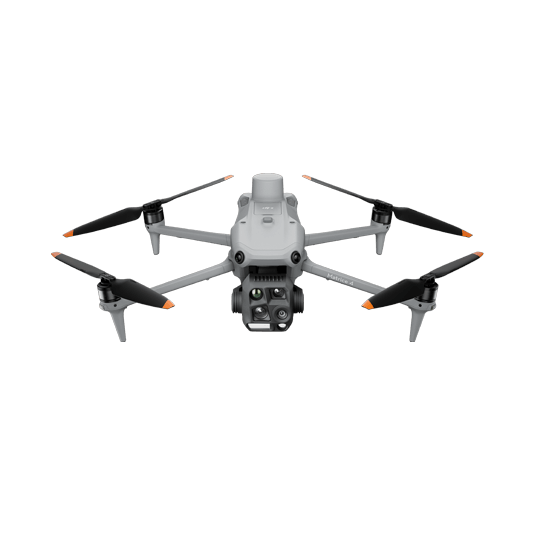
The DJI Matrice 4E is a portable surveying and mapping drone suitable for single-pilot operations. Paired with DJI Terra, it can generate accurate 2D and 3D models with significant reduction on the ground control points.
The Matrice 4E's compact size and user-friendly design facilitate rapid setup, mission planning, and pack-up, making it highly suitable for last-minute or urgent survey requirements in a busy operational environment.
Reliability and high accuracy even when flying at high altitudes.
The Real-Time Terrain Follow mode allows the Matrice 4E to adjust its altitude in real time, ensuring a consistent height relative to the terrain being mapped.