Powerline Inspection

Transmission and Distribution inspections are crucial for preventing power losses and line failures. Automated drone flights can perform daily inspections of transmission lines, allowing for early identification of defects. With thermal cameras, these drones can detect abnormal high temperatures in equipment such as wire clamps and knife switches, enabling timely fault detection and the prevention of system failures.

Painpoints

Advantages

Solution

Reliable Transmision Line Inspection

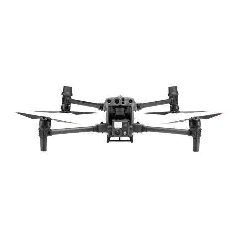
The DJI Matrice 30 Series delivers portable yet powerful performance, capable of handling challenging conditions. This solution enables inspection professionals to capture high-quality visual and thermal (M30T) images for precise defect identification. Plan inspection tasks using the DJI Pilot 2
app’s waypoint flight mission feature, allowing for repeatable missions that increase efficiency.

This solution is compatible with the DJI Cellular module[1] for 4G-enhanced image transmission, extending its effective operating range in complex urban or mountainous environments.
 

Drone Platform

Matrice 30T
Weight (incl. two batteries): 3770 ± 10 g.
Max Flight Time: 41 min.

Payload And Software

DJI Pilot 2
Ground control

Workflow

  1. Mission Planning:
    – Plan inspection route by using Waypoint Mission or fly manually while using the Live Mission Recording feature for future replicable missions.
  2. Data Collection:
    – Upon arrival at the takeoff point, quickly deploy the drone and initiate the previously saved inspection route. The drone will automatically follow the flight route.
  3. Data Analysis:
    – Analyze the inspection photos manually to identify and locate any defects.
    – Integrate inspection data with existing asset management systems for further analysis, trend tracking, and maintenance planning.
  4. Reporting and Documentation:
    – Generate comprehensive inspection reports that include visual and thermal imagery, defect identification, and recommendations for corrective actions.
 

Multipurpose Drone Inspection

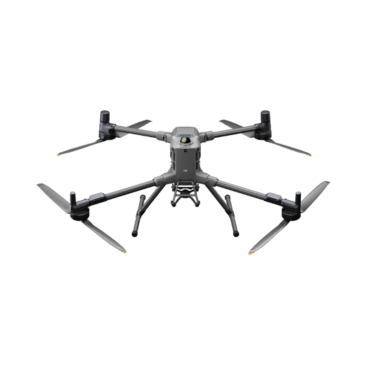
The DJI Matrice 350 RTK is a reliable platform with interchangeable payloads to meet specific task requirements. From mapping to inspection, the Matrice 350 RTK offers comprehensive operational capabilities for inspection teams.

This solution is compatible with the DJI Cellular module[1] for 4G-enhanced image transmission, extending its effective operating range in complex urban or mountainous environments.

Drone Platform

Matrice 350 RTK
Weight: Approx. 6.47 kg(with single downward gimbal and two TB65 batteries).

Payload And Software

Zenmuse H30T
Wide-Angle RGB Camera: 1/1.3-inch CMOS, 48MP effective pixels
Zoom RGB Camera: 1/1.8-
Zenmuse L2
Integrates frame LiDAR, a self-developed high-accuracy IMU system, and a 4/3 CMOS
DJI Terra
Modeling and flight mission plan

Workflow

  1. Powerline Modeling Mission:
    – Use the Matrice 350 RTK equipped with the Zenmuse L2 and fly directly over powerline using the Powerline Follow feature. The Zenmuse L2 sensor can detect and identify power lines even in complex environments with vegetation or other obstacles.
    – Once the power line is identified , the drone will then autonomously plan a flight path along the power line, maintaining a safe distance and adjusting its altitude as needed.
  2. Model Processing:
    – Import the data into DJI Terra to generate the LiDAR point cloud and plan the transmission corridor inspection route.
  3. Inspection Mission:
    – Import the route task into the Matrice 350 RTK and issue the inspection command with a single click.
  4. Data Analysis:
    – Analyze the inspection photos manually or use model detection to identify defects in the transmission corridor.

Portable Distribution Networks Inspection

The compact and portable DJI Matrice 4T, equipped with high-performance visible light and thermal imaging cameras, is ideal for comprehensive temperature inspections of distribution network equipment.

This solution is compatible with the DJI Cellular module[1] for 4G-enhanced image transmission, extending its effective operating range in complex urban or mountainous environments.

Drone Platform

DJI Matrice 4T
Weight: 1219 g (with propellers)
Max Flight Time (without wind): 49 minutes

Payload And Software

DJI Pilot 2
Ground control

Workflow

  1. Mission Planning:
    – Plan inspection route by using Waypoint Mission or fly manually while using the Live Mission Recording feature for future replicable missions.
  2. Data Collection:
    – Upon arrival at the takeoff point, quickly deploy the drone and initiate the previously saved inspection route. The drone will automatedly follow the flight route.
  3. Data Analysis:
    – Analyze the inspection photos manually to identify and locate any defects. Integrate inspection data with existing asset management systems for further analysis, trend tracking, and maintenance planning.
  4. Reporting and Documentation:
    – Generate comprehensive inspection reports that include visual and thermal imagery, defect identification, and recommendations for corrective actions.

Automated Routine Inspection

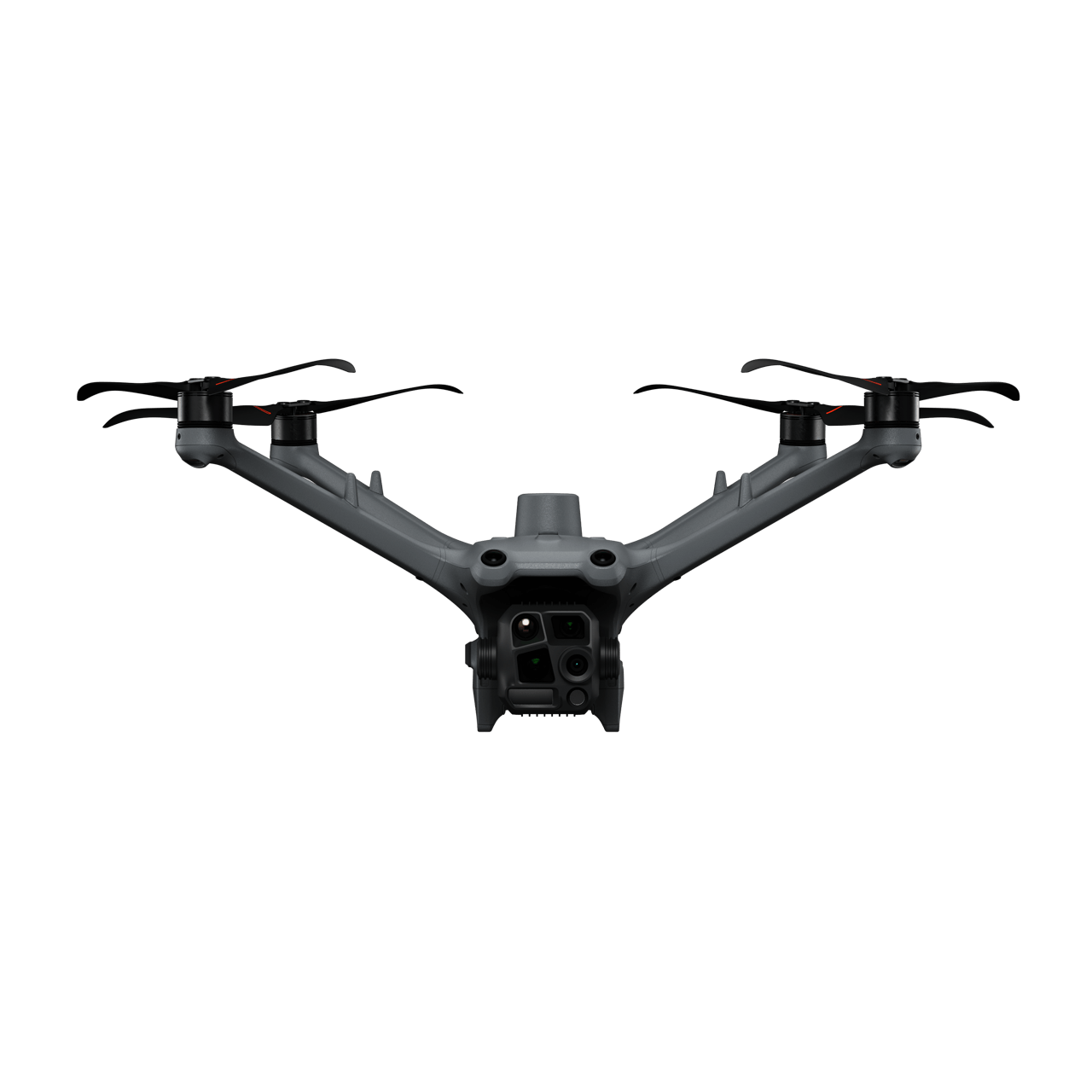
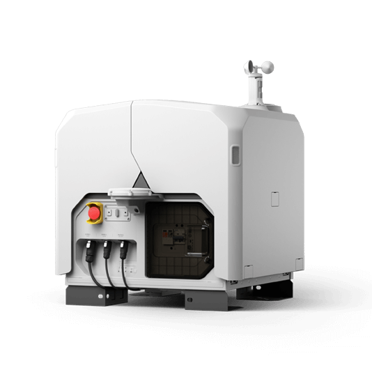
DJI Dock 3 (including the DJI Matrice 4D Series) integrates with DJI FlightHub 2 to enable remote, repeatable inspections, enhancing efficiency and ensuring personnel safety. Schedule automated visual or thermal inspections, and ensure inspection quality with live streams via DJI FlightHub 2.

This solution is compatible with the DJI Cellular module[1] for 4G-enhanced image transmission, extending its effective operating range in complex urban or mountainous environments.

Drone Platform

DJI Matrice 4D
Weight: 1850 g
Max Flight Time: 54 minutes
DJI Matrice 4TD
Weight: 1850 g
Max Flight Time: 54 minutes
DJI Dock 3
Weight: 55 kg (without the drone)
Size: 1760×745×485 mm (L×W×H, dock cover opened)

Payload And Software

DJI FlightHub 2
Drone and dock’s cloud management system

Workflow

  1. Mission Planning:
    – Use DJI FlightHub 2 or preferred third-party sofware to plan inspection routes based on high-definition models of transmission lines and towers.
    – Or import previously saved inspection flight routes to the DJI FlightHub 2 via the Pilot 2 app using the Live Mission Recording feature.
  2. Data Collection:
    – Using DJI FlightHub 2 select the preferred dock and scheduled inspection mission.
    – The DJI Matrice 4D series drones execute inspection tasks as planned, and the captured results are automatically uploaded to the DJI FlightHub 2 cloud platform.
    1. Data Analysis:
      – Analyze the inspection photos manually or export to a third-party model detection software to identify defects or deterioration on the components.

Request for a Quote