Substation Inspection

Substations and converter stations serve as essential nodes within the electrical grid, and their secure and reliable functioning depends on thorough and systematic inspections. Drones offer the agility and versatility to create precise digital replicas of these substations and conduct detailed examinations of electrical components using both visible and infrared imaging. This allows for the early detection of faults, thereby reinforcing the continuous and stable operation of the substations.

Painpoints

Advantages

Solution

Portable Inspection

The DJI Matrice 4E / 4T drones are compact and capable of navigating through the relatively narrow spaces between equipment. They are equipped with high-definition visible light and infrared cameras (M4T) that can generate accurate 3D models and conduct detailed inspections of power equipment, thereby reducing risks and manual labor.

Drone Platform

DJI Matrice 4T
Weight: 1219 g (with propellers)
Max Flight Time (without wind): 49 minutes
DJI Matrice 4E
Weight: 1219 g (with propellers)
Max Flight Time (without wind): 49 minutes

Payload And Software

DJI Pilot 2
Ground control
DJI FlightHub 2
Drone and dock’s cloud management system
DJI Terra
Modeling and flight mission plan

Workflow

  1. Mission Planning:
    – Use software like DJI Terra or DJI FlightHub 2 to plan inspection flight routes based on high-definition 3D models of the substation.
  2. Data Collection:
    – Upload the flight path to the Matrice 4E / 4T drone.The drone automatically execute pre-planned flight route, capturing visible light and infrared inspection photos.
  3. Data Analysis:
    – Import the images to DJI Thermal Analysis Tool to analyze the inspection results manually or with import to a third-party software to identify equipment defects using model detection.

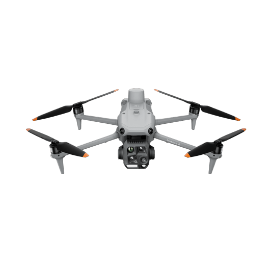
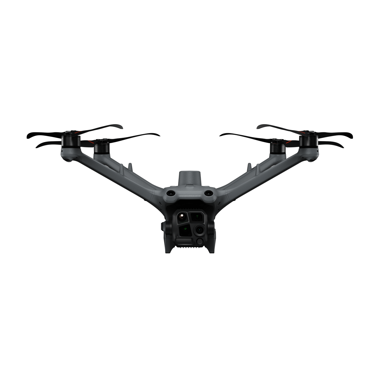
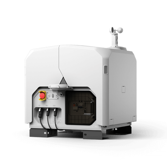
Automated Remote Inspection

The DJI Dock 3 and the Matrice 4TD, when paired with DJI FlightHub 2, enable automated inspection operations. Schedule an inspection task, and the DJI Dock 3 will automatically collect the data and upload the results to the cloud platform for further analysis and processing.

Drone Platform

DJI Matrice 4TD
Weight: 1850 g
Max Flight Time: 54 minutes
DJI Dock 3
Weight: 55 kg (without the drone)
Size: 1760×745×485 mm (L×W×H, dock cover opened)

Payload And Software

DJI Pilot 2
Ground control
DJI FlightHub 2
Drone and dock’s cloud management system
DJI Terra
Modeling and flight mission plan

Workflow

  1. Mission Planning:
    – Use DJI FlightHub 2 to plan inspection routes based on high-definition 3D models of the substation.
    – Or import previously saved inspection flight routes to the DJI FlightHub 2 via the Pilot 2 app using the Live Mission Recording feature.
  2. Data Collection:
    – Using DJI FlightHub 2, select the preferred dock and scheduled inspection mission.
    – The Matrice 4TD will execute the inspection tasks according to the plan, and upload the captured data to DJI FlightHub 2.
  3. Data Analysis:
    – Analyze the images to detect defects or required maintenance work. Transfer the data to a third-party software to identify equipment defects using model detection.

Multipurpose Drone Inspection

The DJI Matrice 350 RTK is a reliable platform with interchangeable payloads tailored to meet the needs of specific tasks. From mapping to inspection, the Matrice 350 RTK provides comprehensive operational capabilities for inspection teams.

Drone Platform

Matrice 350 RTK
Weight: Approx. 6.47 kg(with single downward gimbal and two TB65 batteries).

Payload And Software

Zenmuse H30T
Wide-Angle RGB Camera: 1/1.3-inch CMOS, 48MP effective pixels
Zoom RGB Camera: 1/1.8-inch CMOS, 40MP effective pixels, 34× hybrid optical zoom
Zenmuse L2
Integrates frame LiDAR, a self-developed high-accuracy IMU system, and a 4/3 CMOS
DJI Terra
Modeling and flight mission plan

Workflow

  1. Substation Digital Twin:
    – Use the DJI Pilot 2 app and Matrice 350 RTK equipped with the Zenmuse L2 to generate a 3D model using the mapping mission functions.
    – Import the data into DJI Terra to generate the LiDAR point cloud of the substation. Use the model to plan expansion and maintenance work.
  2. Thermal Inspection Mission:
    – Using the Matrice 350 RTK equipped with the Zenmuse H30T payload, manually fly to capture thermal readings of the key components of the substation. Use the Live Mission Recording feature to easily repeat the same missions in the future.
  3. Data Analysis:
    – Analyze the inspection photos manually or use model detection to identify defects in the transmission corridor.

Request for a Quote