Pipeline Inspection

Oil fields feature numerous pipelines across diverse terrains, which are vulnerable to environmental factors. Remote locations complicate on-site inspections and pose safety risks. Utilizing drones equipped with visible light and thermal cameras for automated inspections can effectively mitigate these challenges.

Painpoints

Advantages

Solution

Portable Pipeline Inspection

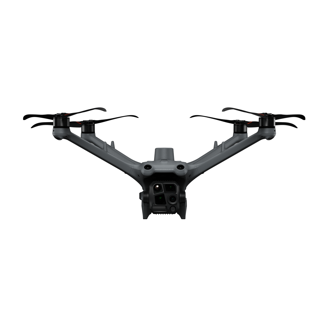
The compact and portable DJI Matrice 4T, outfitted with high-performance visible light and thermal imaging cameras, is ideal for comprehensive pipeline inspections.

This solution is compatible with the DJI Cellular module[1], which provides 4G-enhanced image transmission, thereby extending its effective operating range in complex urban or mountainous terrains.

Drone Platform

DJI Matrice 4T
Weight: 1219 g (with propellers)
Max Flight Time (without wind): 49 minutes

Payload And Software

DJI Pilot 2
Ground control

Workflow

  1. Mission Planning:
    – Plan inspection route by using Waypoint Mission or manually fly the inspection route while using the Live Mission Recording feature for future replicable missions.
  2. Data Collection:
    – Upon arrival at the takeoff point, quickly deploy the drone and initiate the previously saved inspection. The drone will automatically follow the flight route.
    – During the flight, you can detect a risk situation in real time and stop the route for verification.
  3. Data Analysis:
    – After the aircraft automatically lands, export the photos taken for further analysis and identification.

Reliable Performance Inspection

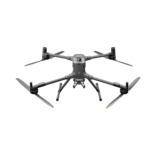
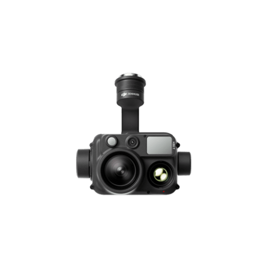
The DJI Matrice 30 Series delivers portable yet powerful performance with an extended flight range of up to 15 km and ingress protection to withstand harsh weather conditions. This solution enables inspection professionals to detect abnormalities using the high-resolution visual and thermal (M30T) sensors, dual-control operations, and precise re-shooting.

This solution is compatible with the DJI Cellular module[1] for 4G-enhanced image transmission, thereby extending its effective operating range in complex urban or mountainous terrains.

Drone Platform

Matrice 30 Series
Weight (incl. two batteries): 3770 ± 10 g.
Max Flight Time: 41 min

Payload And Software

DJI Pilot 2
Ground control

Workflow

  1. Mission Planning:
    – Plan inspection route by using Waypoint Mission or manually fly the inspection route while using the Live Mission Recording feature for future replicable missions.
  2. Data Collection:
    – Upon arrival at the takeoff point, quickly deploy the drone and initiate the previously saved inspection mission. The drone will automatically follow the flight route.
    – During the flight, you can detect a risk situation in real time, stop the route for verification and pinpoint the location for further repair work.
  3. Data Analysis:
    – Analyze the images to detect defects or required maintenance work by manually reviewing the data collected. Transfer the data to a third-party software to identify equipment defects using model detection.

Leak Detection Inspection

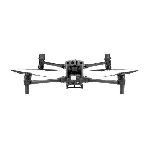
The DJI Matrice 400 is a dependable platform with interchangeable payloads tailored to meet the needs of specific tasks. Whether for mapping or inspection, the Matrice 400 delivers comprehensive operational capabilities for facility managers. When paired with a third-party gas detector sensor, inspection teams can identify gas leaks that may otherwise be undetectable to the human eye.

This solution is compatible with the DJI Cellular module[1] for 4G-enhanced image transmission, thereby extending its effective operating range in complex urban or mountainous terrains.

Drone Platform

DJI Matrice 400
Weight: 9740±40 g (with batteries)
Max Takeoff Weight: 15.8 kg
Max Payload: 6 kg

Payload And Software

DJI Pilot 2
Ground control
Zenmuse H30T
Wide-Angle RGB Camera: 1/1.3-inch CMOS, 48MP effective pixels
Zoom RGB Camera: 1/1.8-

Workflow

  1. Data Collection:
    – Fly the drone manually using the DJI Pilot 2 app or the third-party payload software.
    – If the gas detector senses a leak it will trigger an alert. Capture images and sensor data on the spot to evaluate the situation.
  2. Data Analysis:
    – Review the gas sensor and visual inspection data to detect defects or required maintenance work.

Automated Routine Inspection

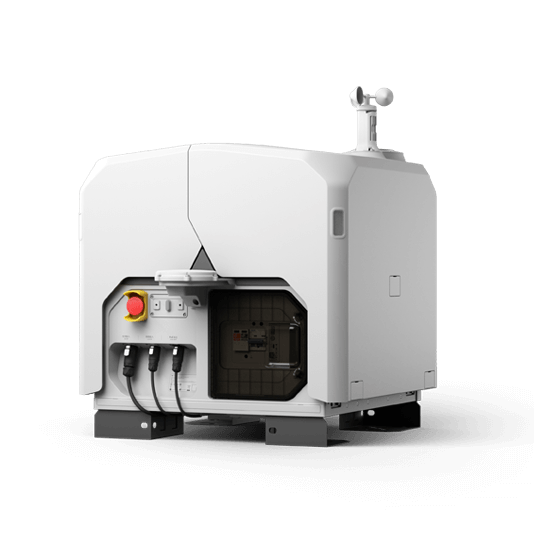
DJI Dock 3 (including the DJI Matrice 4D Series) integrates with DJI FlightHub 2 to enable remote, repeatable inspections, enhancing efficiency and ensuring personnel safety. Schedule automated visual or thermal inspections, and ensure inspection quality with live streams via DJI FlightHub 2.

This solution is compatible with the DJI Cellular module[1] for 4G-enhanced image transmission, extending its effective operating range in complex urban or mountainous environments.

Drone Platform

DJI Matrice 4D
Weight: 1850 g
Max Flight Time: 54 minutes
DJI Matrice 4TD
Weight: 1850 g
Max Flight Time: 54 minutes
DJI Dock 3
Weight: 55 kg (without the drone)
Size: 1760×745×485 mm (L×W×H, dock cover opened)

Payload And Software

DJI FlightHub 2
Drone and dock’s cloud management system

Workflow

  1. Mission Planning:
    – Use DJI FlightHub 2 or preferred third-party sofware to plan inspection routes based on pipeline models and maps.
    – Or import previously saved inspection flight routes to the DJI FlightHub 2 via the Pilot 2 app using the Live Mission Recording feature.
  2. Data Collection:
    – Using DJI FlightHub 2, select the preferred dock and scheduled inspection mission.
    – The DJI Matrice 4D or Matrice 4TD will execute inspection tasks as planned, and the captured results will be automatically uploaded to the DJI FlightHub 2 cloud platform.
  3. Data Analysis:
    – Analyze the inspection photos manually or export to a third-party model detection software to identify defects or deterioration on the components.

Request for a Quote