Bridge Inspection

Drones equipped with high-resolution cameras can meticulously inspect critical bridge components, including decks, piers, and cables. Utilizing LiDAR technology, they can swiftly generate BIM and digital twin models, facilitating faster and more cost-effective assessments. This technological approach aids builders, maintainers, and auditors in comprehending the bridge’s condition and in planning maintenance in a proactive manner.

Painpoints

Advantages

Solution

Bridge Visual Inspection

The Matrice 400, equipped with the Zenmuse P1, captures high-resolution images of bridge structures and key components to identify cracks or signs of deterioration. With integrated rotating LiDAR and mmWave radar, it provides a 360-degree obstacle avoidance sensor, enabling closer inspections without compromising flight safety.

Drone Platform

DJI Matrice 400
Weight: 9740±40 g (with batteries)
Max Takeoff Weight: 15.8 kg
Max Payload: 6 kg

Payload And Software

Zenmuse P1
45 MP Full-frame camera.
Global Mechanical Shutter Shutter Speed 1/2000 Seconds.
DJI Pilot 2
Ground control
DJI Terra
Modeling and flight mission plan

Workflow

  1. Mission Planning:
    – Using third-party software, plan an inspection waypoint route based on bridge 3D models or use live mission recording with AI spot checking in the DJI Pilot 2 to create a routine inspection route.
  2. Data Collection:
    – Import the flight route into Pilot 2 and execute the mission. Turn on the RTK for better results.
  3. Data Processing:
    – Reconstruct vertical 2D models through DJI Terra. Improve model texture by editing it using DJI Modify.
  4. Data Analysis:
    – Analyze the inspection photos or detail modes to identify and locate any defects. Document the required maintenance using the images or model findings.

Bridge Digital Twin Asset Management

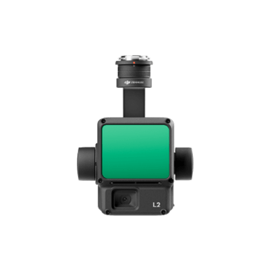
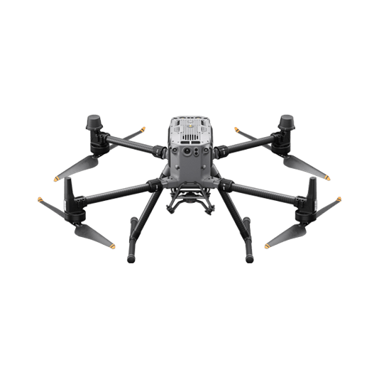
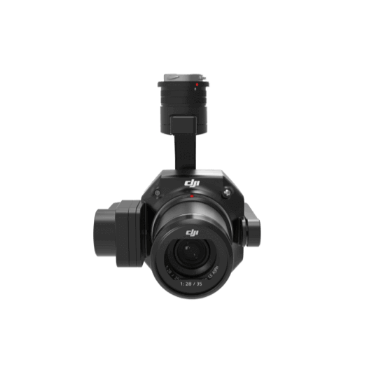
The Matrice 350 RTK, when equipped with the Zenmuse P1, can generate high-resolution 3D models for detailed visual inspection. With the Zenmuse L2 LiDAR attached, the Matrice 350 RTK performs laser point cloud digitization to model bridges accurately.

Utilize DJI Terra to produce both photogrammetry and point cloud models. Enhance your photogrammetry models by editing and correcting textures with DJI Modify.

Drone Platform

Matrice 350 RTK
Weight: Approx. 6.47 kg(with single downward gimbal and two TB65 batteries).

Payload And Software

Zenmuse P1
45 MP Full-frame camera.
Global Mechanical Shutter Shutter Speed 1/2000 Seconds.
Zenmuse L2
Integrates frame LiDAR, a self-developed high-accuracy IMU system, and a 4/3 CMOS
DJI Pilot 2
Ground control
DJI Terra
Modeling and flight mission plan
DJI Modify
Intelligent 3D model editing software

Workflow

  1. Data Collection:
    – Using the DJI Pilot 2 app and the 3D Mapping Flight Mission feature, captured the data with the Zenmue L2 to generate a 3D point cloud model of the bridge or generate a photogrammetry 3D model using the Zenmuse P1.
  2. Data Processing:
    – Input the data to DJI Terra, then reconstuct a high resolution 3D model.
    – Use DJI modify to remove the floating, black hole, which will improve model appereance.
  3. Data Analysis:
    – Share the models as digital twin BIM to get the overview enviroment and set up suitable maintanence plan.

Portable Maneuverable Inspection

The DJI Matrice 4E drones are compact and adept at navigating through the relatively narrow spaces found within complex structures. They are equipped with high-definition visible light cameras that can generate accurate 3D models and conduct detailed inspections of bridges, thereby reducing risks and manual labor.

Drone Platform

DJI Matrice 4E
Weight: 1219 g (with propellers)
Max Flight Time (without wind): 49 minutes

Payload And Software

DJI Pilot 2
Ground control

Workflow

  1. Mission Planning:
    – Using the DJI Pilot 2 app and the 3D Mapping Flight Mission feature, generate a model of the bridge to be used as a reference for detailed inspection planning.
    – Use software like DJI Terra or DJI FlightHub 2 to plan inspection flight routes based on high-definition 3D models of the bridge using Slope Mission and Geometric Flight Mission.
  2. Data Collection:
    – Upload the flight path to the Matrice 4E drone. The drone automatically execute pre-planned flight route, capturing inspection photos. Complement the data collection by manually flying into hard to reach locations and capture different angles of the bridge.
  3. Data Analysis:
    – Review the images manually or import to a third-party software to identify structure defects using model detection.

Request for a Quote